 ATLASANTE
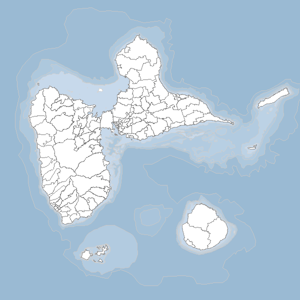
SHOM_Guadeloupe_bathymetrie_carte
Bathymétrie en périphérie de la Guadeloupe
Simple
- Date (Revision)
- 2014-09-30T18:40:00
- Date (Publication)
- 2014-01-30T00:00:00
- Theme
-
- bathymetrie
- guadeloupe
- Region
-
- France
- Keyword
- France
- Type
- Theme
- Date (Publication)
- 2025-05-28
- Unique resource identifier
- geonetwork.thesaurus.external.theme.prodige
- Use limitation
- Utilisation libre sous réserve de mentionner la source (a minima le nom du producteur) et la date de sa dernière mise à jour
- Access constraints
- Restricted
- Use constraints
- Copyright
- Classification
- Unclassified
- Spatial representation type
- Vector
- Denominator
- 100000
- Metadata language
- fre
- Character set
- UTF8
- Topic category
-
- Elevation
- Description
- Guadeloupe
N
S
E
W
))
- Hierarchy level
- Dataset
- Feature catalogue citation
- File identifier
- 28829145-2f5e-4499-98eb-c38b0d6e2981 XML
- Metadata language
- Français
- Character set
- UTF8
- Hierarchy level
- Dataset
- Date stamp
- 2014-09-30T18:59:40
- Metadata standard name
- ISO 19115:2003/19139
- Metadata standard version
- 1.0
Overviews
large_thumbnail
thumbnail
Spatial extent
N
S
E
W
Provided by

Associated resources
Not available