 ATLASANTE
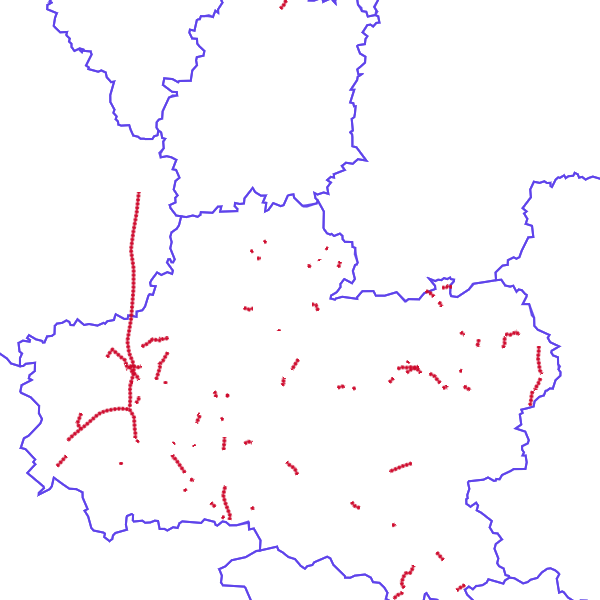
Département du Loiret (45) - Routes coupées le 03 juin 2016 à 16h
Département du Loiret (45) - Routes coupées le 03 juin 2016 à 16h
Simple
- Date (Revision)
- 2016-06-03T16:24:02
- Date (Publication)
- Theme
-
- inondations loiret
- Region
-
- France
- Keyword
- Préparation à la gestion de crise
- Type
- Theme
- Date (Publication)
- 2025-01-17
- Unique resource identifier
- geonetwork.thesaurus.external.theme.prodige
- Keyword
- Préparation à la gestion de crise
- Keyword
- Brouillons
- Type
- Theme
- Date (Publication)
- 2025-01-17
- Unique resource identifier
- geonetwork.thesaurus.external.theme.prodige
- Access constraints
- Restricted
- Use constraints
- Copyright
- Other constraints
- L124-4-I-3 du code de l’environnement (Directive 2007/2/CE (INSPIRE), Article 13.1.g)
- Spatial representation type
- Vector
- Metadata language
- fre
- Character set
- UTF8
- Topic category
-
- Health
N
S
E
W
))
- Hierarchy level
- Dataset
- Statement
- Gestion de crise
- Feature catalogue citation
- File identifier
- 5a8f2268-1b6e-4c2d-9758-90a09cb14ba3 XML
- Metadata language
- Français
- Character set
- UTF8
- Hierarchy level
- Dataset
- Date stamp
- 2019-03-13T22:01:21
- Metadata standard name
- ISO 19115:2003/19139
- Metadata standard version
- 1.0
Overviews
large_thumbnail
thumbnail
Spatial extent
N
S
E
W
Provided by

Associated resources
Not available