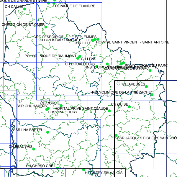
ARS Hauts-de-France - Téléexpertise - Cartographie des projets envisagés par les sites effecteurs (2020/10/09)
Téléexpertise - Cartographie des projets envisagés par les sites effecteurs (2020/10/09)- Région Hauts-de-France
Simple
Identification info
- Date (Creation)
- 2020-10-09T11:15:00
- Date (Publication)
- 2020-10-09T11:20:00
- Citation identifier
- https://catalogue.atlasante.fr/geonetwork/srv/b5ba7920-eef8-4954-b8e6-dfda09995913
- Point of contact
-
Organisation name Individual name Electronic mail address Role ARS Hauts-de-France
Khalil GUETARNI
Point of contact
- Theme
-
-
Téléexpertise
-
Médecins
-
Spécialistes
-
Hauts-de-France
-
Etablissements de santé
-
-
Region
-
-
HAUTS-DE-FRANCE
-
-
INSPIRE Service taxonomy
-
-
infoMapAccessService
-
- Keywords
-
- Keywords
-
- Keywords
-
- Keywords
-
-
Domaines
-
-
Brouillons
-
-
Domaines
-
-
E-Santé
-
- Access constraints
- Restricted
- Use constraints
- Restricted
- Other constraints
-
sécurité publique
- Classification
- Restricted
- User note
-
Accès soumis à la signature de l'acte d'engagement et au respect des conditions générales d'utilisation
- Service Type
- invoke
- Description
-
Hauts-de-France
))
- Coupling Type
- Tight
- Contains Operations
-
Operation Name Distributed Computing Platforms Connect Point GUETARNI KHALIL
Web services Accès à la carte interactive
Web services Accès au fichier contexte OWS de la carte
Web services Accès à la carte interactive
Web services Accès au fichier contexte OWS de la carte
Web services Accès à la carte interactive
Web services Accès au fichier contexte OWS de la carte
Web services Accès à la carte interactive
Web services Accès au fichier contexte OWS de la carte
Web services https://carto.atlasante.fr/context/getOws/16128433 Accès à la carte interactive
Web services Accès au fichier contexte OWS de la carte
Web services https://carto.atlasante.fr/context/getOws/16128433 Accès à la carte interactive
Web services https://catalogue.atlasante.fr/geosource/consultation?id=16128433
- Coupled Resource
-
Operation Name Scoped name Identifier GetCapabilities
Communes 2f29f748-8cbb-46f9-a5fe-ff5b9b946c45
GetCapabilities
EPCI cfb7a04a-0920-4fd2-891a-c1907c601c8f
GetCapabilities
Departements 745163ac-32a6-4bbb-b1fe-8b6a89303844
GetCapabilities
Regions ecf8d985-03f9-4dcd-b7a9-8d6edd5e7a3e
- Reference system identifier
- EPSG / RGF93 / Lambert-93 (EPSG:2154) / 7.9
- Units of distribution
-
liens associés
- OnLine resource
-
Protocol Linkage Name WWW:LINK-1.0-http--link
https://catalogue.atlasante.fr/geosource/consultation?id=16128433 Accès à la carte
- Hierarchy level
- Interactive map
- Statement
-
ARS-Hauts-de-France
Metadata
- File identifier
- b5ba7920-eef8-4954-b8e6-dfda09995913 XML
- Metadata language
- Français
- Character set
- UTF8
- Hierarchy level
- Interactive map
- Hierarchy level name
-
service
- Date stamp
- 2024-10-24T16:49:57
- Metadata standard name
-
ISO 19115:2003/19139
- Metadata standard version
-
1.0
- Metadata author
-
Organisation name Individual name Electronic mail address Role ARS HDF
GUETARNI KHALIL
Point of contact
Overviews

Spatial extent
))
Provided by
