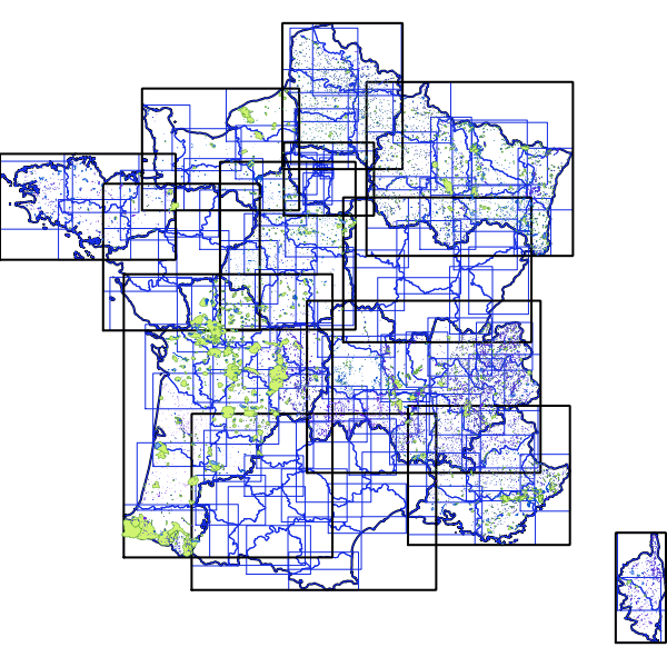
DGS - POC AQUA SISE
POC Aqua-Sise
Simple
Identification info
- Date (Publication)
- 2018-01-29T00:00:00
- Date (Creation)
- 2018-01-29T00:00:00
- Citation identifier
- https://catalogue.atlasante.fr/geonetwork/srv/20ca6a71-7507-48b3-9c6e-8faba8ec2b89
- Point of contact
-
Organisation name Individual name Electronic mail address Role Custodian
- Theme
-
-
INSPIRE Service taxonomy
-
-
infoMapAccessService
-
- Keywords
-
- Keywords
-
- Keywords
-
- Keywords
-
-
Domaines
-
-
Brouillons
-
-
Domaines
-
-
Brouillons
-
Eau potable
-
- Access constraints
- Restricted
- Use constraints
- Restricted
- Other constraints
-
sécurité publique
- Classification
- Restricted
- User note
-
Accès soumis à la signature de l'acte d'engagement et au respect des conditions générales d'utilisation
- Service Type
- invoke
))
- Coupling Type
- Tight
- Contains Operations
-
Operation Name Distributed Computing Platforms Connect Point Accès à la carte
Web services Accès à la carte interactive
Web services Accès au fichier contexte OWS de la carte
Web services Accès à la carte interactive
Web services Accès au fichier contexte OWS de la carte
Web services Accès à la carte interactive
Web services Accès au fichier contexte OWS de la carte
Web services Accès à la carte interactive
Web services https://catalogue.atlasante.fr/geosource/consultation?id=11105423 Accès au fichier contexte OWS de la carte
Web services https://carto.atlasante.fr/context/getOws/16128857 Accès à la carte interactive
Web services https://catalogue.atlasante.fr/geosource/consultation?id=16128857
- Coupled Resource
-
Operation Name Scoped name Identifier GetCapabilities
Communes 2f29f748-8cbb-46f9-a5fe-ff5b9b946c45
GetCapabilities
EPCI cfb7a04a-0920-4fd2-891a-c1907c601c8f
GetCapabilities
Departements 745163ac-32a6-4bbb-b1fe-8b6a89303844
GetCapabilities
Perimetres_de_Protection_Eloignee_PPE b069b7f1-5b9e-44cf-9c86-f4ec40b764be
GetCapabilities
Perimetres_de_Protection_Rapprochee_PPR 839296df-6b79-4f5e-9b64-4b150bf7ba08
GetCapabilities
Perimetres_de_Protection_Immediate_PPI 6a9a8085-4d42-4aac-9f7f-1907218edcfe
GetCapabilities
Captages__donnees_SISE_Eaux 48717fed-896b-4d4b-8c24-a52c65aa012d
GetCapabilities
PSV ea89903e-ba8f-4920-bc7e-34b74da2d2fa
GetCapabilities
Regions ecf8d985-03f9-4dcd-b7a9-8d6edd5e7a3e
- Reference system identifier
- EPSG / RGF93 / Lambert-93 (EPSG:2154) / 7.9
- Units of distribution
-
liens associés
- OnLine resource
-
Protocol Linkage Name WWW:LINK-1.0-http--link
https://catalogue.atlasante.fr/geosource/consultation?id=16128857 Accès à la carte
- Hierarchy level
- Service
Metadata
- File identifier
- 20ca6a71-7507-48b3-9c6e-8faba8ec2b89 XML
- Metadata language
- Français
- Character set
- UTF8
- Hierarchy level
- Service
- Hierarchy level name
-
service
- Date stamp
- 2021-03-04T13:32:41
- Metadata standard name
-
ISO 19115:2003/19139
- Metadata standard version
-
1.0
- Metadata author
-
Organisation name Individual name Electronic mail address Role Point of contact
Overviews

Spatial extent
))
Provided by
